Wildfire News
‹ All PostsFrom Moorland to Front Door: How UK’s Wildfire Threat Is Changing
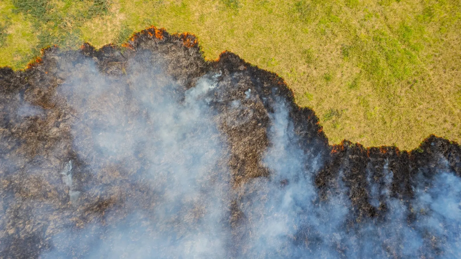
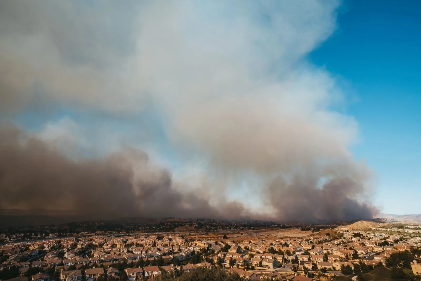
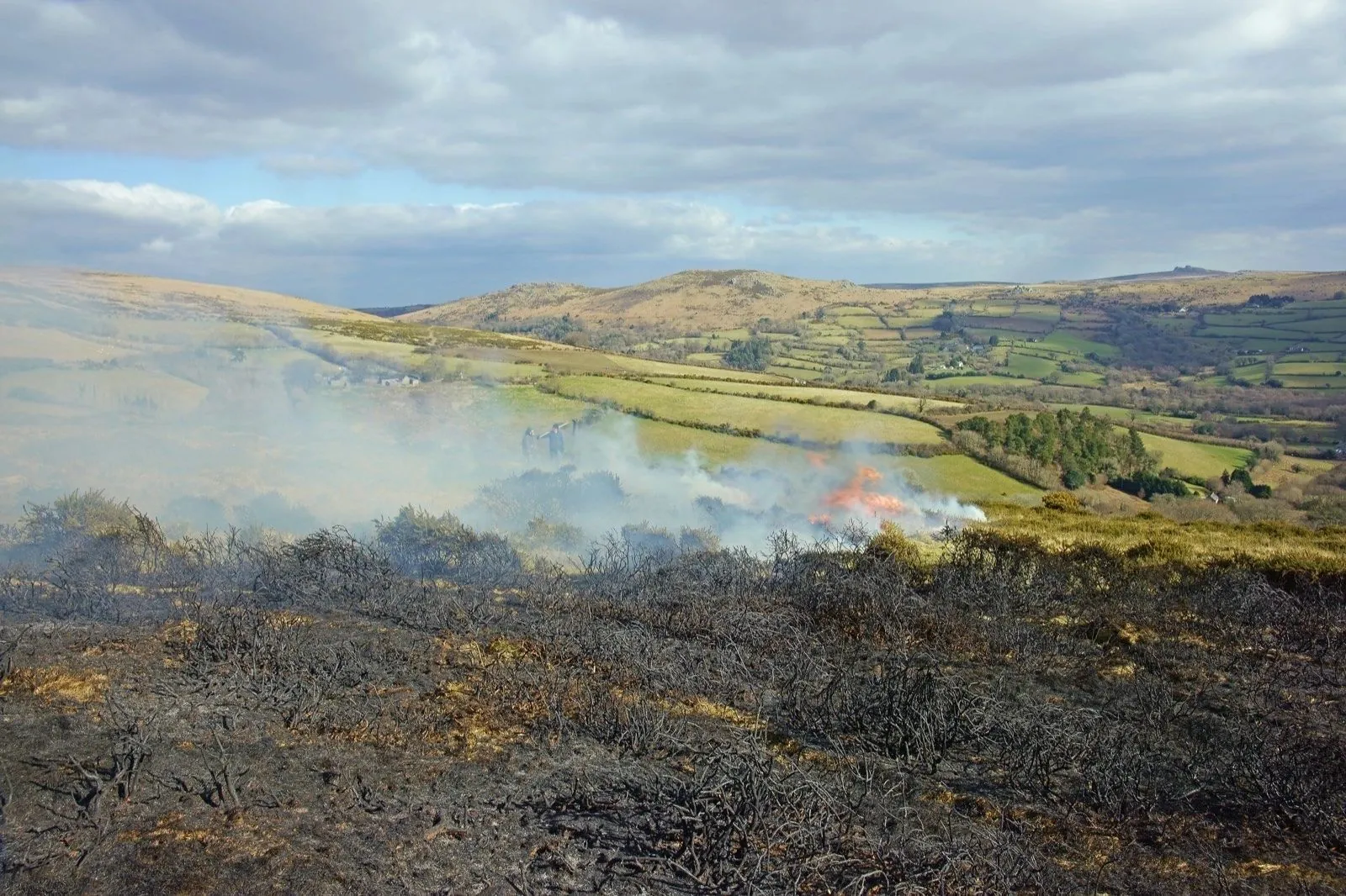
For generations, the familiar British image of wildfire has been a distant one: smoke rising from moorland, heath or open countryside, far from the streets where most people live.
The summer of 2026 has challenged that assumption.
By 16 August, fire and rescue services had responded to 1,132 wildfires across England and Wales, already exceeding the 1,017 recorded throughout all of 2025. July alone produced 458 incidents—the busiest month in the National Resilience data series. (NFCC)
Yet incident count is only part of the story.
On 13 August, fire moved from open land into homes at Stourbridge in the West Midlands. The official aftermath was 37 affected properties: 19 destroyed and 18 damaged. Elsewhere, large South Wales incidents remained active for weeks, absorbed extensive resources and required reinforcement from specialist teams, partner agencies and the military. (WMFS)
These incidents represent two distinct but connected wildfire challenges.
A comparatively small fire near housing can become an immediate human emergency.
A large or persistent countryside fire can become an endurance test for the entire response system.
The UK wildfire threat is therefore no longer measured only in hectares. It is increasingly defined by proximity, duration, concurrent demand and consequence.
The UK’s wildfire threat is no longer measured only in hectares. A smaller fire near homes can become a greater human emergency, while a remote fire lasting weeks can drain the capacity needed for everything else.
What Sky News’ analysis found
Sky News examined fires of at least 30 hectares across England and Wales during 2026.
Its analysis found that:
- 19% came within 500 metres of built-up areas;
- 17% remained observable in satellite data across more than three days;
- and 15% affected at least 500 hectares—three times the equivalent rate in 2025. (Sky News)
These findings describe a specific sample of larger, satellite-mapped fires. They should not be rewritten as applying to every wildfire attended by a British fire and rescue service.
They nevertheless identify three important changes.
First, significant fires are reaching closer to homes and businesses.
Second, a greater proportion are persisting across several days.
Third, more incidents are reaching substantial geographic scale.
Each trend creates a different demand on responders. Together, they turn wildfire from a specialist countryside risk into a wider question of housing, infrastructure and national resilience.
Why the datasets do not all measure the same thing
Wildfire statistics can appear contradictory when their definitions are not explained.
The NFCC operational count includes incidents meeting one or more criteria relating to area, flame length, resource commitment, duration or serious threat. A fire does not need to exceed 30 hectares to qualify. That is why NFCC’s 1,132-incident total cannot be compared directly with Sky’s smaller sample of large fires. (NFCC)
EFFIS primarily provides satellite-derived information about fire activity and burned areas. Satellite data can be affected by cloud, smoke, image timing, mapping resolution and later perimeter refinement.
Ordnance Survey asks a different question again: how many homes sit close to the edge between settlements and vegetated land?
Its analysis found that more than 1.8 million homes—around 7% of British housing—lie within 100 metres of urban–rural edges. Ordnance Survey explicitly cautions that these properties are not equally vulnerable; proximity makes them relevant to preparedness, not certain future fire losses. (Ordnance Survey)
A credible national picture therefore needs several measures:
- number of operational incidents;
- mapped burned area;
- duration;
- proximity to people and infrastructure;
- property consequences;
- and the resources required to manage the emergency.
No single measure is sufficient.
Stourbridge shows why area is not the same as consequence
The Stourbridge fire was not among Britain’s largest incidents by area.
It was among the most consequential.
West Midlands Fire Service was first called on the afternoon of 13 August, when temperatures at Kew Gardens reached 38.1°C—the fifth-highest temperature recorded in the United Kingdom. The fire spread rapidly across open land and into nearby residential properties. (Met Office)
Approximately 100 firefighters were reported to have responded. Roads were crossed, residents were moved away from danger and the operational priority changed from vegetation suppression to life safety, evacuation and structural protection. (Sky News)
The final official property total—19 destroyed and 18 damaged—demonstrates why acreage alone cannot define wildfire severity. (WMFS)
Once fire reaches a residential street, the operational problem changes.
Firefighters must protect people and buildings while managing evacuations, smoke, access, water supply, medical needs, damaged utilities and the possibility of further spread. Community recovery continues after the flames are controlled, as households face displacement, structural assessment, insurance and rebuilding.
Stourbridge also exposes the limits of presenting aerial capability as a universal answer. Aircraft may provide value in remote or extensive terrain, but they cannot replace fire engines, crews and close structural protection once flames are moving among homes.
South Wales shows the cost of duration and concurrency
The South Wales fires demonstrate the second side of Britain’s developing wildfire problem.
The Blaenavon incident began in July and remained operationally significant into the second half of August. Later satellite-based reporting placed the affected landscape above 4,000 hectares, with peat-rich ground contributing to persistent underground heat and recurring hotspots. (Sky News)
At Llangynidr, the fire service reported an estimated 400-hectare incident supported by specialist resources. Sky’s analysis showed the mapped area increasing substantially during the first five days. (South Wales Fire and Rescue Service)
On 16 August, South Wales Fire and Rescue Service was reported to be attending 14 concurrent wildfire incidents. Military support was deployed through the Military Aid to the Civil Authorities framework, with the reported commitment rising to around 200 personnel during the most demanding period. (Sky News)
The important lesson is not simply that individual fires were large.
It is that several demanding operations were active at the same time.
Every prolonged wildfire ties up people, vehicles, control-room capacity, specialist officers, logistics and management attention. Fire and rescue services must still cover house fires, road collisions, rescues and other daily emergencies across their communities.
Concurrency converts a series of local incidents into a wider resilience problem.
Britain’s rural–urban interface is becoming a planning issue
The boundary between town and countryside is not always obvious in Britain.
Housing may sit beside golf courses, agricultural fields, scrub, woodland, reservoirs, railway lines and narrow vegetated corridors. This patchwork can sometimes interrupt continuous fuel. It can also place homes and infrastructure immediately beside combustible land and potential ignition sources. (Ordnance Survey)
The rural–urban interface should not be treated as a uniform danger zone.
Risk depends on vegetation condition, land management, slope, wind, building characteristics, access and the likelihood of ignition. A home within 100 metres of an urban edge is not automatically a high-risk property.
But 1.8 million homes represent a scale that cannot be ignored in national planning.
Preparedness may need to influence:
- local resilience assessments;
- housing and infrastructure planning;
- utility continuity;
- land-management responsibilities;
- community warning;
- emergency access;
- and insurance understanding.
The question is no longer only how to defend distant moorland.
It is how to manage the places where open land meets daily life.
The UK faces two wildfire-capacity problems
Britain’s developing wildfire risk can be divided into two broad operational demands.
Rapid interface incidents
These can move from vegetation into homes and infrastructure over a short period. They require strong local ground response, fire engines, evacuation support, structural protection and immediate command decisions.
Stourbridge illustrates this category.
Prolonged landscape incidents
These may remain active across inaccessible or peat-rich terrain for days or weeks. They require specialist knowledge, repeated monitoring, crew rotation, reinforcement, logistics and continuing availability.
Blaenavon and Llangynidr illustrate this category.
A national system must prepare for both.
Specialist wildfire teams cannot replace sufficient local capacity at a residential emergency. Local fire engines alone may struggle to sustain a multi-week moorland campaign without wider support.
The challenge is integration: ensuring that local response, regional mutual aid, specialist capability and national resilience assets reinforce one another rather than being treated as substitutes.
Aerial support and ground response have different roles
Aerial support can add value when terrain is remote, difficult to access or too extensive for rapid ground observation.
It may assist authorised responders with broad situational awareness and appropriate suppression support. But its utility depends on weather, visibility, airspace coordination, crew availability and the nature of the incident.
Stourbridge demonstrates that ground crews remain decisive where fire has reached buildings. South Wales demonstrates why additional field and aerial capability may be relevant across large and persistent countryside incidents. (Sky News)
The responsible conclusion is not “aircraft or fire engines”.
It is aircraft and fire engines, used for different authorised purposes within one command structure.
Workforce and operational availability
The debate over fire-service resources must be handled carefully because workforce figures use different scopes and definitions.
Sky reported that UK firefighter numbers had fallen by approximately 20% between 2010 and 2025. Official England-only statistics, measured in full-time-equivalent firefighter roles, show a 14% reduction over the decade to March 2025. A separate Local Government Association survey estimated UK wholetime and retained personnel using different categories again. (Sky News)
The data cannot be merged into one simple national total.
The strategic concern is clearer.
A firefighter or appliance contributes to immediate capacity only when it is available, properly staffed and not already committed elsewhere. During prolonged or concurrent wildfire activity, nominal workforce size may differ considerably from what a control room can deploy to the next emergency.
The Fire Brigades Union argues that long-term reductions in staffing and equipment have weakened resilience. The NFCC has welcomed new investment while also calling for a long-term strategy, continued staffing, specialist teams, equipment and national aerial capability. (Sky News)
These positions should not be reduced to a binary argument.
Specialist investment matters.
Baseline local capacity matters.
Control rooms, crew rotation and everyday emergency cover matter as well.
What the new investment does—and does not do
In June 2026, the UK Government announced five specialist wildfire teams hosted by services in Lancashire, Greater Manchester, Northumberland, London and South Wales. The teams were intended to provide deployable support across England. (GOV.UK)
The same announcement referred to a £97 million National Resilience upgrade covering vehicles and equipment for major emergencies.
That £97 million is not a wildfire-only budget. The programme supports wider national capabilities relevant to incidents such as floods, structural collapse and other complex emergencies as well as wildfires. (GOV.UK)
The teams add expertise and reinforcement.
They do not create a permanent specialist unit inside every local fire authority, and they do not replace the engines and crews needed for ordinary emergency cover.
The strategic test is whether specialist capacity arrives soon enough, integrates effectively and allows local services to maintain resilience elsewhere.
Prevention remains part of response capacity
Every avoidable ignition prevented leaves resources available for emergencies that cannot be prevented.
The NFCC repeatedly emphasised public vigilance during the 2026 heatwaves because dry vegetation allowed relatively small ignition events to develop quickly. By 10 August, more than two-thirds of England and all of Wales were officially in drought. (NFCC)
Some South Wales incidents were being investigated as potentially deliberate, but suspicion, arrest, charge and conviction must remain distinct. The causes of separate fires should not be generalised into one national explanation. (Sky News)
Public communication should reduce risk without inadvertently explaining how or where a fire could be started.
In the United Kingdom, anyone seeing a wildfire or an immediate threat to life should call 999 and ask for the Fire and Rescue Service. (NFCC)
Heat and drought create conditions—not every ignition
The 13 August temperature of 38.1°C occurred during what the Met Office described as a remarkable and exceptionally dry summer across much of England and Wales. Forty sites recorded at least 36°C that day. (Met Office)
Heat and drought can dry vegetation and increase the potential for rapid spread after ignition.
They do not establish the cause of a particular fire.
Ignition, fuel condition, weather, land management and access are separate factors. Long-term climate change may alter the frequency or severity of heat and drought, but any incident-level conclusion still requires evidence about the specific fire.
The value of climate and weather analysis is not to replace investigation.
It is to help authorities understand how the operating environment is changing.
UK wildfire governance is distributed
Fire and rescue services remain locally organised. Larger incidents can draw on neighbouring services, specialist national capabilities, Local Resilience Forums, devolved institutions and, in exceptional circumstances, Military Aid to the Civil Authorities.
This distribution can provide flexibility and local knowledge.
It also places a premium on interoperability, shared information and role clarity.
National resilience is not a separate organisation arriving to take control. It is a framework through which specialist assets reinforce authorised local and regional command.
Technology introduced into this environment must strengthen that relationship, not create another disconnected layer.
Human command remains central
Wildfire operations involve decisions affecting residents, responders, homes, roads, utilities, airspace and public resources.
Prioritisation must remain with authorised professionals.
Technology should not independently decide:
- which community receives protection;
- when residents should leave or return;
- where public aircraft operate;
- how scarce resources are allocated;
- or whether an incident has been made safe.
Its responsible role is to improve visibility, support authorised action and preserve accountability.
Human oversight is not a limitation on advanced wildfire capability.
It is the structure that makes its use legitimate.
The PRAESI perspective
PRAESI is developing a patented integrated wildfire-response system that publicly connects field deployment, aerial suppression capability, sensing, post-action assessment, repeatable readiness and operator oversight.
PRAESI was not involved in the Stourbridge or South Wales incidents. It is not part of the UK National Resilience programme, is not one of the five government wildfire teams and does not claim current integration or operational approval within UK fire and rescue services.
PRAESI does not claim that aerial capability would have prevented the Stourbridge losses. Nor does it position emerging technology as a replacement for firefighters, fire engines, control rooms or evacuation authorities.
The responsible connection is strategic.
The UK’s 2026 experience shows that wildfire systems must complement local ground response, accommodate incidents with very different requirements and preserve authorised visibility over resources committed across multiple emergencies.
PRAESI remains on a staged proof-build pathway. Its technical architecture, operational logic, partner-integration arrangements and proposed deployment configurations remain under controlled disclosure.
The public principle is straightforward:
Wildfire response should operate as an integrated and accountable system—not as a collection of disconnected tools.
Questions UK wildfire readiness should ask
- How should a large remote wildfire and a smaller residential-edge fire be assessed differently?
- Which communities sit near vegetated land without being labelled uniformly high-risk?
- How is genuine resource availability distinguished from nominal staffing or fleet size?
- How much ordinary emergency cover remains while a prolonged wildfire is active?
- How quickly can specialist teams reinforce local command?
- Where can authorised aerial support add value, and where is ground response decisive?
- How should England-and-Wales incident data be reconciled with Great Britain and UK-wide planning?
- How is the effect of each intervention assessed?
- How are crews and assets restored to readiness after sustained deployment?
- How are housing loss and community recovery incorporated into after-action review?
- How can deliberate-fire risk be discussed without revealing vulnerabilities?
- How can emerging technology support professional command without replacing frontline capability?
These are preparedness questions, not accusations against the services and personnel responding throughout the summer.
Conclusion
The UK wildfire threat is changing in more than one direction.
Fires are affecting larger mapped areas and remaining visible for longer. More are approaching built-up land. At the same time, comparatively small incidents can create severe consequences when they reach housing.
Stourbridge demonstrates the human cost of proximity.
Blaenavon and Llangynidr demonstrate the operational cost of duration.
Together, they show why wildfire preparedness must connect local fire engines, specialist teams, regional reinforcement, national resilience, appropriate aerial support and continuing assessment.
Firefighters, control-room personnel, local authorities, military teams, farmers, volunteers, police, ambulance services, land managers and affected communities all carried part of the 2026 response.
Technology cannot eliminate wildfire risk.
Aircraft cannot replace firefighters at the front door.
Specialist teams cannot replace sustainable local cover.
And hectares alone cannot measure harm.
Responsible innovation should strengthen readiness, situational awareness, repeatable capability and accountable human command.
Britain’s wildfire challenge is no longer confined to the moor.
It has reached the places where the countryside meets everyday life.
⸻
FAQ
Why was the 2026 wildfire season considered exceptional?
National Resilience data recorded 1,132 wildfires across England and Wales by 16 August, already exceeding the full-year 2025 total of 1,017. Sky’s separate satellite analysis also found larger fires lasting longer and approaching built-up areas more frequently than in 2025. (NFCC)
Which PRAESI geographic category applies?
Category 2 — Europe.
The country is the United Kingdom, while the principal comparable statistical scope is England and Wales. The article concerns multiple separate wildfire incidents rather than one national fire.
What does rural–urban interface mean?
It refers broadly to areas where homes, businesses or infrastructure meet vegetated countryside. Britain’s interface is often a patchwork of grassland, farmland, scrub, woodland, roads and housing rather than a single clear boundary. (Ordnance Survey)
How many properties were affected in the Stourbridge wildfire?
West Midlands Fire Service recorded 37 affected properties: 19 completely destroyed and 18 damaged. (WMFS)
Why do NFCC and satellite wildfire figures differ?
They measure different things. NFCC uses an operational definition based on factors including area, flame length, resources, duration and threat. Sky’s satellite analysis focused on mapped fires of at least 30 hectares. Satellite observations may also be refined as imagery improves. (NFCC)
Would firefighting aircraft solve the UK wildfire problem?
No single capability can do so. Aircraft may support authorised operations across large or inaccessible terrain, but they cannot replace ground crews, engines, evacuation support and structural protection when fire reaches homes.
What is PRAESI developing?
PRAESI is developing a patented integrated wildfire-response system connecting field deployment, aerial suppression capability, sensing, post-action assessment, repeatable readiness and operator oversight. PRAESI remains on a staged proof-build pathway and does not claim current deployment in the United Kingdom.
SOURCE NOTE
Source note: This article contains independent commentary and analysis inspired by Sky News reporting published on 22 August 2026 concerning the escalating wildfire threat in the United Kingdom.
Sky’s findings concerning proximity, duration, burned area and the size of larger fires are based on its own analysis of EFFIS, satellite and incident data and are attributed accordingly.
Operational totals and definitions were checked against the National Fire Chiefs Council. Stourbridge property figures were reconciled against West Midlands Fire Service. South Wales context was compared with South Wales Fire and Rescue Service reporting and subsequent national coverage. Housing-proximity analysis was checked against Ordnance Survey, government investment against official UK Government material, and temperature information against the Met Office.
Data scopes differ. Principal operational and satellite comparisons concern England and Wales; Ordnance Survey’s housing analysis concerns Great Britain; and official workforce statistics cited concern England or use separate UK survey definitions.
Figures and incident status are stated as of 22 August 2026 at 22:10 BST.
All original reporting, interviews, photography, satellite imagery, charts, maps, videos and graphic rights remain with their respective publishers, agencies and credited creators.